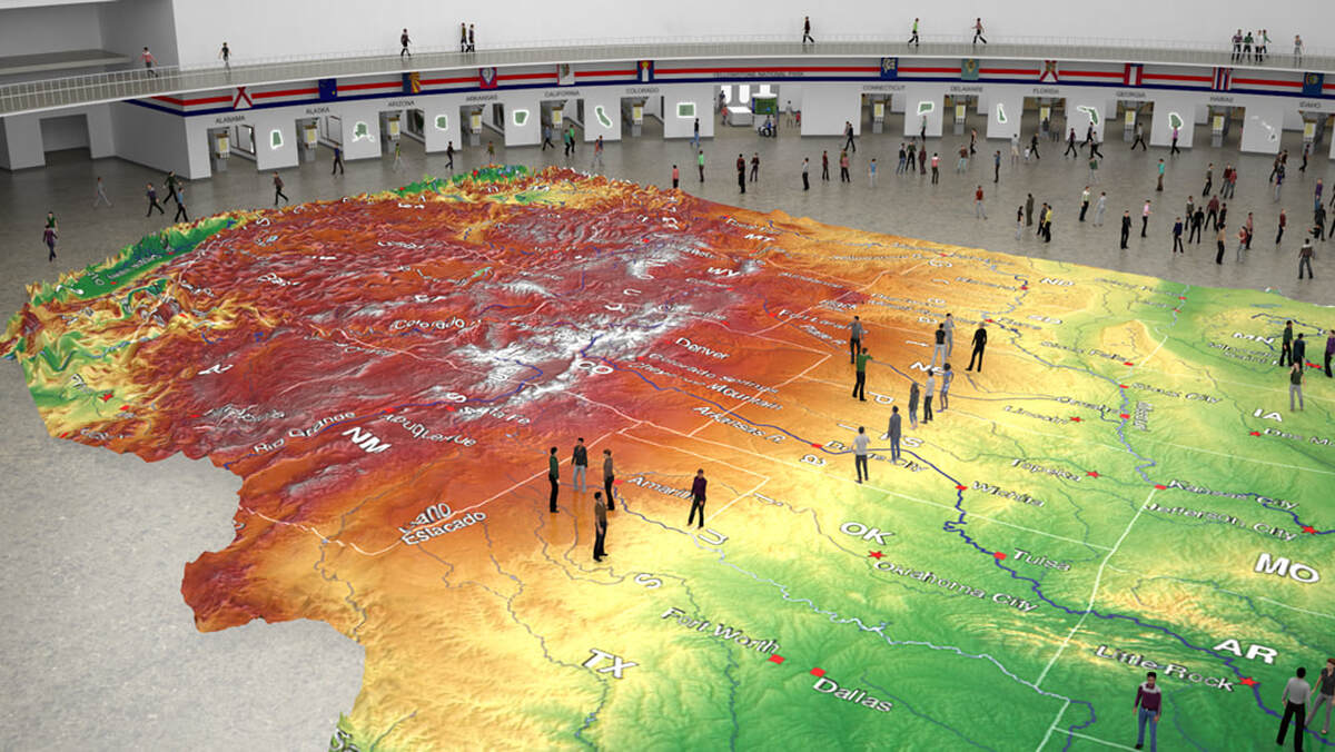
The centerpiece of the NSVC is Earthwalk USA, a 100 yard long three dimensional relief map of America that can be walked on. Digital technology will be used to illuminate imagery directly into the map from underneath. Alaska and Hawaii will be accessed via tunnels from the main dome. Domes covering these two states will be retractable, so that in appropriate weather they can be explored outdoors. The islands of Hawaii will be set in a wading pool.
Walk 100 yards from the tip of Maine to the coast of California
The physical relief map – earthwalk USA – is meant to be walked on. Kids can climb the peaks and seniors can stand on the flatlands. Many areas provide access to patrons with disabilities. The map will contain 3-dimensional elevation changes and contours and show major roads, airports, railways, towns, and villages. It will note scenic areas, national and state parks, and other important points of interest. Alaska and Hawaii are situated in correct geospatial position relative to the ‘lower 48’ and also correctly aligned to true north.
Grand scale: 1:6,250,000 or one inch = one mile
The map of the contiguous United States featured under the indoor dome is as long as a football field. When you stand on it, or crouch down, you’ll note the precise detail afforded by the scale of one inch equals a mile. Note that height will be exaggerated: the mountain ridges crest at your knees, and the valleys drop under them. Without exaggeration, the Rocky Mountains would top out at 3-4 inches – and the Grand Canyon would be one inch deep!
Geoshows transform the experience
Beneath the map is a digital display that can be programmed to project everything from atmospheric pressure to Lewis & Clarks’ famed journey up the Missouri. Auditorium seating on the balcony provides a uniquely literal bird’s eye view of America across a spectrum of geological, historical, environmental, and civic eras.
Renderings courtesy of CADnetics, Inc.


